.png)


Drones in Surveillance and Mapping: Transforming Modern Applications
In recent years, drone technology has revolutionized various industries, with surveillance and mapping being two of the most significant areas of transformation. These unmanned aerial vehicles (UAVs) have become essential tools for gathering data, monitoring activities, and providing critical insights across different sectors.
The use of drones in surveillance has gained widespread popularity due to their ability to provide real-time monitoring over large areas. These aerial devices are equipped with high-resolution cameras, thermal imaging sensors, and advanced communication systems that enable comprehensive surveillance operations. Drones have become invaluable assets for law enforcement agencies, assisting in crowd monitoring during large events, traffic management, and tracking criminal activities. By providing a bird’s-eye view, drones help reduce response times and increase the accuracy of operations.
Maintaining secure borders is a critical concern for governments. Drones are deployed to monitor border areas for illegal activities, including smuggling and unauthorized crossings. Their ability to fly at various altitudes and remain airborne for extended periods makes them ideal for this task. Companies are increasingly using drones for facility surveillance to protect assets and prevent unauthorized access. Warehouses, factories, and construction sites benefit from drone patrols that provide continuous monitoring without the need for extensive human resources.
Drones play a pivotal role in search and rescue missions, particularly in areas affected by natural disasters. Equipped with thermal sensors, they can detect heat signatures, locate survivors, and deliver essential supplies to inaccessible regions.
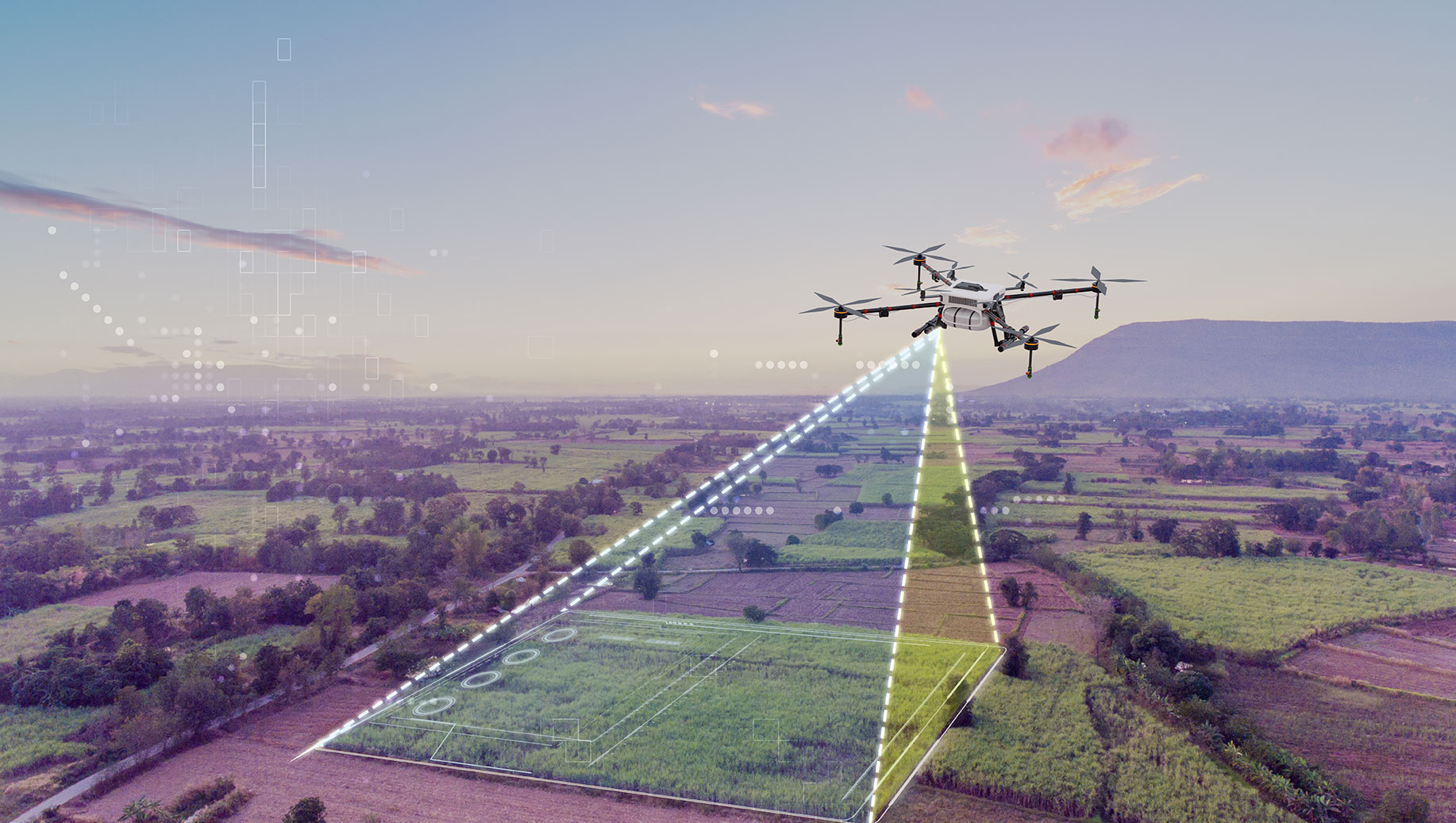
Mapping has traditionally been a time-consuming and labor-intensive process. Drones have revolutionized this domain by enabling fast and accurate data collection, making it easier to create detailed maps and models. Drones equipped with LiDAR sensors and high-resolution cameras capture precise topographical data essential for creating accurate maps, conducting land surveys, and planning infrastructure projects.
In agriculture, drones are used to create detailed maps of farmlands. These maps help farmers analyze soil health, monitor crop growth, and optimize irrigation systems, ultimately increasing yield and reducing resource wastage. Urban planners and construction companies rely on drone mapping to assess land conditions, monitor construction progress, and identify potential issues. Drones provide a cost-effective and time-efficient way to gather comprehensive data.
Drones are also used for mapping forests, tracking wildlife, and monitoring environmental changes. They provide valuable insights into deforestation, pollution levels, and the impact of climate change on ecosystems.
The adoption of drones in surveillance and mapping offers numerous advantages, including reduced operational costs, enhanced data accuracy, and improved safety. However, there are also challenges, such as regulatory restrictions, data privacy concerns, and the need for skilled operators.
Drones have emerged as indispensable tools in surveillance and mapping, transforming how data is collected and analyzed across various industries. As technology continues to advance, the applications of drones will only expand, offering even greater potential for efficiency, accuracy, and innovation. Organizations that embrace this technology will be better positioned to meet the demands of the modern world and address complex challenges with precision and agility.
Leave a Comment
Your email address will not be published. Required fields are marked *